Montour ridge is among the last contiguous forests in Montour county. It is a significant landmark with both ecological and historical value. It is my hope to capture some of this heritage with video interviews of local people. Please contact me if interested in participating. Click here for contact info for Van Wagner
Volume 1
Volume 2
Volume 3
Native American Cairn on Montour Ridge
Devil's Featherbed (song by Van and Ollie Wagner)
Liberty Iron Furnace
What Once Was
The Ore of Montour
Danville Charcoal Making
Bio of Claudius Boatman
Submitted by Glenda Strouse Nov. 2015
TUCKAHOE RIDGE ROAD
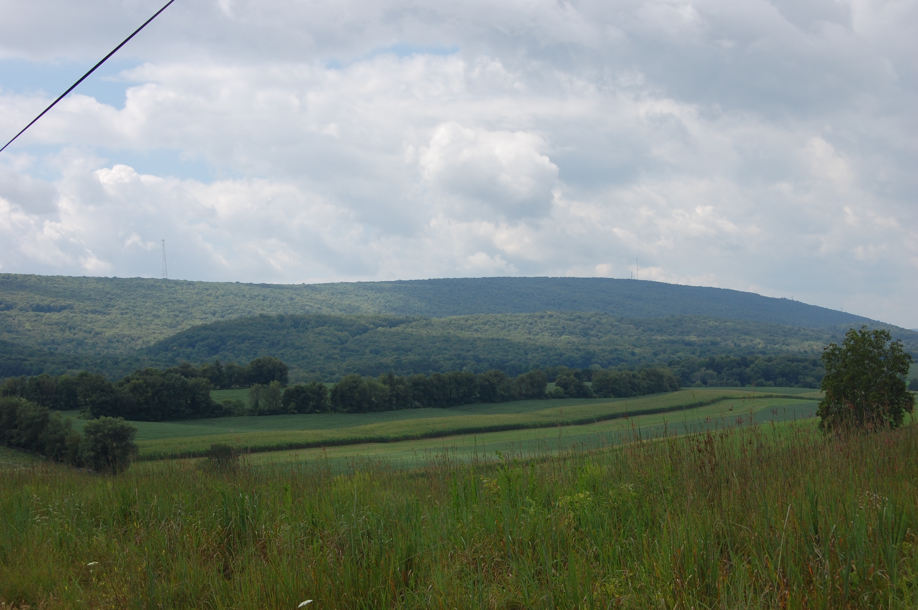
“Tuckahoe” Ridge Road is a 6.7 mile stretch of road from PA 147 to US 11 including 1.4 miles owned and maintained by Point Township (as Point Township Road 703) and 5.3 miles owned and maintained by PennDOT (as State Route 1024). It was originally named Tuckahoe Ridge Road also the Tuckahoe Valley Road on some deeds. It is located in the Tuckahoe Valley in Point Township. The area derived its name from Peter Freese who moved from his plantation in New Jersey at the close of the Revolutionary War to the area three miles west of Northumberland. His plantation there was named “Tuckahoe” and therefore he called his new home Tuckahoe in memory of his former home. The story of the name of his New Jersey home handed down from one generation to another was that Peter Freese had left his hoe in the field after cultivating and an Indian boy came by and walked away with the hoe. And so “Took-a-hoe” became Tuckahoe. His holdings went from the area at the west branch of the Susquehanna (west end of Ridge Road) to the north branch of the river including the Lithia Springs area. The Tuckahoe Mineral Springs Company was established in 1909 where mineral water was bottled and sold from Lithia Springs. The valley is still called Tuckahoe as is the local fire company. The Tuckahoe Ridge parallels the Montour Ridge which divides Point Township from the two Chillisquaque Townships and Montour County on the north. The valley goes to the small ridge on the east.
The 1878 Everets & Stuart History description of Point Township states, “Much of the surface is hilly and poorly adapted to agriculture and nowhere except along the banks of the rivers can the soil be cultivated with profit.” Ironically, there were about 15 farms with land bordering Tuckahoe Ridge Road in the early 1920’s, 30’s and 40’s, possibly 40 in the valley alone with 120 barns and farms in the whole township. There are about 30 barns left..
The rural road cutting through the township was maintained by the local farmers who were responsible for repairing winter damage, filling potholes, and repairing wooden bridges. In the spring, the farmers would gather to clean out the ditches and with the use of a horse drawn grader, fill in the potholes and level the road beds. Later the road was covered with gravel obtained from township gravel quarries. The road was not paved until the late 1930’s. The three wooden bridges were paved in 1938. By 1973 following the 1972 flood, the one lane bridges were replaced.
Telephone service was established in the valley 1905-1908 by the local farmers. The Tuckahoe Telephone Company which took in the Furman’s Cannery area, to Comfort Road and portions of Strawbridge Road was begun by Charles Lesher (the old Lesher farm on Strawbridge Road), Asher Hoffman (the old Crebs farm), Oscar Leighow (the old Sauers farm - now Nottingham) and James Taggert (the old Roush farm, now Roush development). The Spruce Hollow Telephone Company was established by William Knouse (David Campbell farm), Henry F. Geise (John Troxell Jr. farm), Joseph Diehl (old Brouse farm, now Boyer), and William Gesie (now the Hill Top View Development around Strawbridge Rd. & Susquehanna Ave.). The eastern section of Ridge Road and Route 11 was served by Bell’s system extending from Danville. On Route 147, The West Branch Telephone Company was installed by farmers James Heckert, John Hilbish, William H. Mertz Sr., Henry Hackeberg, and William Mertz Jr. The farmers installed their own phones, lines and poles and made necessary repairs. Electricity was provided in the late 1920’s but did not reach all sections of the township until 1948. In 1904, rural postal service, Route 1 was established.
Three of the five one room schoolhouses in Point Township were on Ridge Road. It was the local farmers who originally built the schools as a foundation for the community’s future. Prior to 1882, the 6 township elementary schools did not have names, only numbers. Each school had a director, most likely a farmer, who was responsible for the needs of his school. The three schools on Ridge Road were the #1West Branch Schoolhouse located near Stuck Brothers on Lahr Road now the H. R. Gautsch home, #2 Stone Schoolhouse located near Trinity Church (across the road) now the home of Robert Shutt and #4 County Bridge School which is the first home on the left going west from Rt. 11 now the home of Steve Vankirk. In 1924, #4 County Bridge School and #5, Chulasky Schoolhouse (Route 11 & Buckey Lane) were closed when a second room was added to #3 Spruce Hollow School. In 1926, Priestley School was built and #1West Branch Schoolhouse, #2 Stone Schoolhouse and #6 Kapp Heights School, 14th & Queen Sts. were closed. #3 Spruce Hollow School was closed in 1959. After 8th grade tuition was paid for by Point Township for those attending high school.
There are two churches on Ridge Road. Trinity Lutheran Church was built in 1897 and the Church of the Latter Day Saints on the Roush Development was built in the 1970’s.
Tuckahoe Ridge Road has seen many changes in the years since it first cut through the valley. First probably as an Indian trail from one river branch to the other and then as the settlers came in the 1700’s. They were farmers for the most part, establishing homes and farms.
In the 50+ years that I have lived here and the years since 1934 when this farm came into the family, our family and the farm have seen many changes. The farm was share-cropped until 1946 when my in-laws, Fred and Ruth Strouse and my husband, Tom, then 9 months old, moved here. At that time some of the cows were driven (herded) back Spruce Hollow Road from the Charles Steele farm (now the Danley property) which was at the time managed by Cad Leeser, my husband’s great grandfather (until his death in 1951). Many farms were farmed by tenant farmers who farmed “for the share” in that era. Our farm, a fifth generation dairy and grain farm, is now the only dairy farm in Point Township since 1996 and one of the few farms left on Ridge Road. We are located in the very center of the six+ mile stretch, about three miles from each end (where the newspaper wagon is) on both sides of the road.
There was a day when my son and I went sleigh riding down Ridge Road in the winter. I left him ride in to Little League practice on his bicycle and it was safe to let children wait for the school bus by themselves. Now the traffic flies by. Tractor trailers, cars, motorcycles.
I wonder what the future will bring for Ridge Road. All that has come before was in the name of progress. Already, we have problems with farming on both sides of Ridge Road. Hauling manure, hay, straw, corn, soybeans, silage, tilling, sowing, harvesting. When you think about driving on Ridge Road with more traffic due to the interchange, pretend that your car is 15 foot wide like our combine. Pretend everyone is in a hurry and they think nothing of giving your slower farm vehicles obscene gestures. Pretend that you have to make left turns 40 or 50 times a day hauling silage or manure and have to make a left hand turn into a farm on the left side of the road or visa versa with a twenty foot wagon or other farm equipment on the back. Pretend that you are a farmer.
Glenda Strouse 2015
The Mineral Springs of Tuckeyhoe
From the base of Montour Mountain
Issues forth a bubbling fountain;
Gushes forth a precious nectar
“Fit for gods from Pan to Hector”
Clear and sparkling, pure and healthful
cool, refreshing is the water.
all who drink it - guests and patrons,
Old men, young men, maids or matrons
Feel the tinge of youth within them.
Here the children of the forest -
Caneungo, and Tacknedorus,
Lapawinto and Tychorus,
Quenched their thirst and bartered bear skins
For the trinket of the white man.
Here the Indian braves and Indian maidens
Plighted their troth and sang their love songs
Long before a Curry, Nixon,
Celt or Gaul or Anglo Saxon,
Long before a Robbins, Hammor,
Lemon, Lodge or Issac Sanner
Felled a tree or built a cabin
In the vale of Tuckeyhoe.
Gone are fathers, sons and daughters
Yet remains the healing waters -
Yet remains the scent of pinecones,
Yet remains the scent of spruce and hemlock
In the red man’s Shohomoking
In the white man’s Tuckeyhoe.
Changed the name but not the fountain
Nor the contour of the mountain,
Nor the virtues of the waters,
As they flow from Nature’s store house-
flow from earth’s laboratory.
All in vain have chemists labored
To compound a Lithia water,
That can excel, as a dissolvent
Good Dame Nature’s distillation.
Situated between the rivers,
Susquehanna, named the North Branch
Otchinatchon called the West Branch
Is this fount of healing waters.
For the curing of diseases-
For the relief of the afflicted.
Here the languid, sick and ailing
Here the weak, infirm, and suffering
Here the decrepit, lame and halting
Come to drink the crystal waters -
Drink the remedial waters-
Water healthful - water healing.
Drink the waters, scent the pinecones
Breathe the perfume of birch and spice wood.
Feel your lungs expand within you,
Feel your aching joints unlimber,
Feel disorders fleeing from you,
Feel yourself a man again,
Thankful to the fate that led you,
To that sparkling, healing fountain
Flowing from Montour mountain
In the vale of Tuckeyhoe.
(Point Township, Northumberland, PA)
(note: This was found in an old scrapbook and thought to have been written by a visitor from Philadelphia or other city.)
***Please note Robbins name third stanzas. (my ancestor) GJS